Johannesburg – A week of very cold temperatures is expected across the majority of South Africa which began on Monday, and it is expected to last well into the coming weekend, the South African Weather Service has said.
“The cold temperatures follow in the wake of a cold front that moved over the eastern parts of the country on Sunday evening, sustained by the development of a cut-off low-pressure system over the south-eastern parts of the country,” the SA weather service said in a statement.
“The cut-off low-pressure system will be responsible for the majority of adverse weather expected over the next three days.”
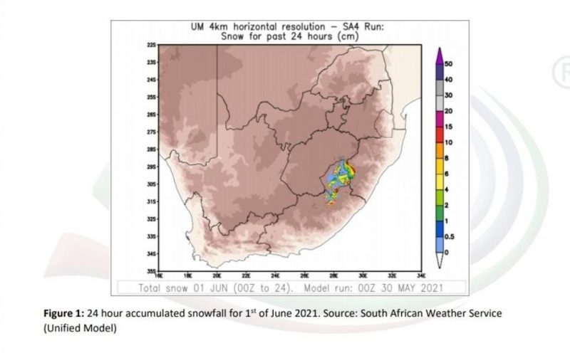
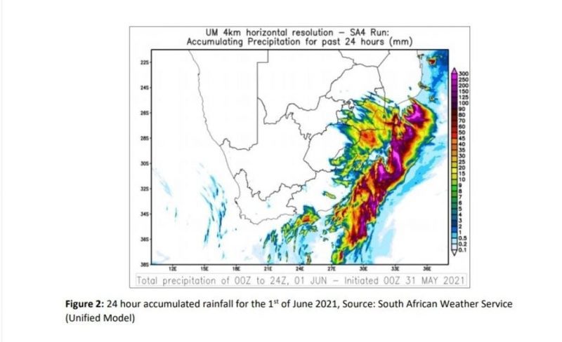
This includes snowfall accumulation of between 5 to 15 cm over Lesotho and the southern Drakensberg mountains in the Eastern Cape, rainfall of a disruptive nature along the Wild Coast and north eastern KwaZulu-Natal as well as wet conditions accompanied by very cold temperatures over the high lying areas of the Eastern Cape, Free State, Mpumalanga, and KwaZulu-Natal, according to the SA weather servive.
Eastern Cape impacts:
Showers and thundershowers are expected over the southern and eastern parts of the Eastern Cape province as the high-pressure system ridges in, combined with the influence of the upper air cut-off low located over eastern parts of the country.
Heavy rain over the Eastern Cape is expected to result in localised flooding of roads and settlements along the Wild coast and adjacent interior from 1 June 2021 into 2 June.
Moreover, cold conditions are expected over Eastern Cape, with very cold conditions over the north eastern high ground of the southern Drakensberg, where disruptive snowfalls are expected from 1 June 2021 into Wednesday morning 2 June.
This could result in major roads and mountain passes being closed as well as loss of livestock and access to some remote communities being interrupted due to snowfall or icy roads.
Free State impacts:
Small stock farmers and the public of the eastern Free State are advised to provide shelter for their animals due to the expected wet, windy, and very cold conditions in the form of showers and thundershowers from tonight.
Light snowfalls are expected over the high-lying areas of Clarens, Fouriesburg, Ficksburg, and Memel which can cause slippery road conditions, especially on the R712, and should the accumulated snowfall reach 1cm or more, this section of road could be closed.
Therefore, the public is advised to avoid these areas and to rather stay home and indoors if possible.
Heavier snowfalls may occur over Phuthaditjhaba, where the community is advised to take the necessary precautions to stay warm and dry in the safest manner possible.
Follow @SundayWorldZA on Twitter and @sundayworldza on Instagram, or like our Facebook Page, Sunday World, by clicking here for the latest breaking news in South Africa. To Subscribe to Sunday World, click here.
Sunday World