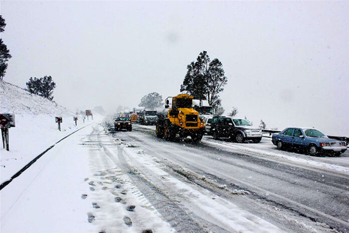
A particularly intense cut-off low system, associated with severe and extreme winter weather, is expected to affect South Africa in the coming days.
It will persist until at least the middle of next week over the eastern provinces, said the South African Weather Service (SAWS).
Western and Northern Cape
The weather service indicated that this system will begin affecting the Western and Northern Cape early on Saturday morning, June 7 2025.
“By Monday, 9 June 2025 and Tuesday, 10 June 2025, this extensive and severe winter weather system will have shifted further east over South Africa, affecting the central and eastern provinces.
“A significant and dramatic drop in daytime temperatures can be expected over all provinces. This with the possible exception of Limpopo. Consequently, farmers of small stock are strongly advised to implement appropriate measures to prevent stock losses due to exposure to bitter cold and wind,” the SAWS said on Thursday.
The weather service has warned of snowfall over almost every province, with the exception of Limpopo.
Traffic flow over mountain passes
Some of these snowfalls will be disruptive, affecting traffic flow over mountain passes, for example. The N3 highway at Van Reenen’s pass on Monday, June 9 2025 and Tuesday, 10 June 2025 are expected to be affected.
“Strong, damaging surface winds over large parts of the interior provinces are expected from Sunday. This will lead to an elevated risk of wildfires, especially over the central and eastern interior, ahead of the cold change. These extreme conditions are expected to persist over some of the eastern provinces until Wednesday.
“Strong to near-gale force coastal winds and very rough seas from Friday along the south-west coast will occur. This will spread to the south and east coasts during Saturday. And it will last until at least Tuesday along the east coast,” it said.
Heavy rainfall with flooding and infrastructure damage will be experienced over parts of the Eastern Cape coast. This will also affect adjacent interior on Sunday, shifting to southern KwaZulu-Natal on Monday.
Bitterly cold Sunday
As of Sunday, many provinces will experience bitterly cold daytime conditions. Maximum temperatures are unlikely to exceed +10 C. These conditions will be exacerbated by strong, gusty winds.
There is also a risk of severe thunderstorms. They will be associated with damaging hail and/or damaging winds over some provinces. And the provinces include North West, Gauteng, Mpumalanga and KwaZulu-Natal, during Monday and Tuesday.
“The South African Weather Service will continue to monitor any further developments. These include expected weather systems and subsequent updates as required,” it said.
- SAnews.gov.za
- A particularly intense cut-off low system, associated with severe and extreme winter weather, is expected to affect South Africa in the coming days.
- It will persist until at least the middle of next week over the eastern provinces, said the South African Weather Service (SAWS).
- Western and Northern Cape The weather service indicated that this system will begin affecting the Western and Northern Cape early on Saturday morning, June 7 2025.
- “By Monday, 9 June 2025 and Tuesday, 10 June 2025, this extensive and severe winter weather system will have shifted further east over South Africa, affecting the central and eastern provinces.
- “A significant and dramatic drop in daytime temperatures can be expected over all provinces.


